
By Open Chronicle Explained
At 8:00 in the morning, something strange happens.
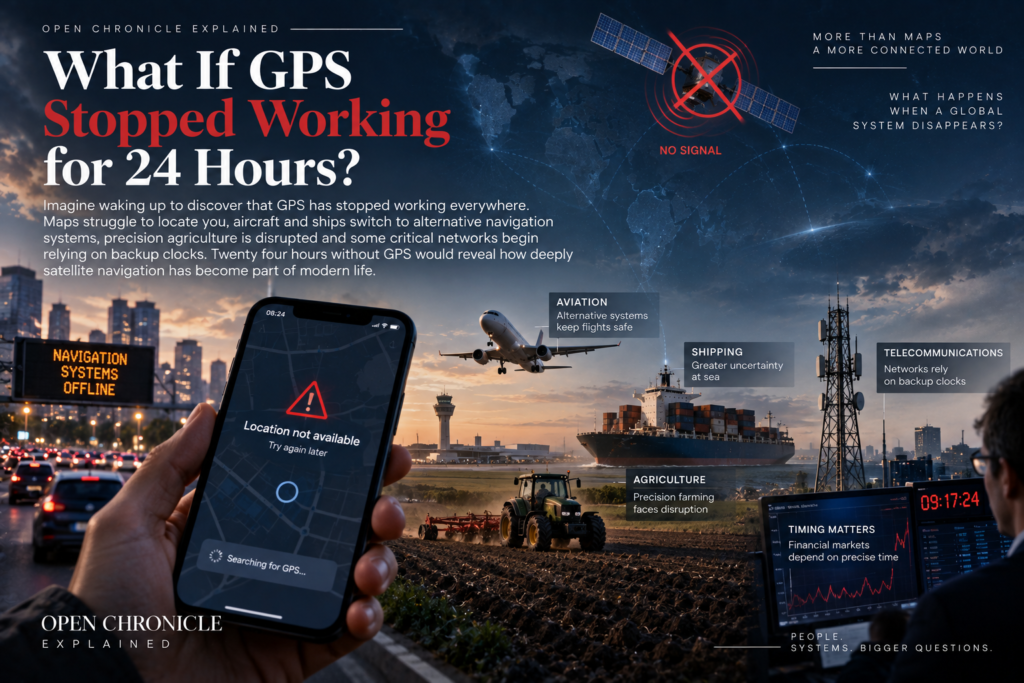
The blue dot disappears from your phone.
Drivers notice that navigation systems cannot determine their positions.
Delivery companies begin receiving location errors.
Ships report problems with satellite navigation.
Aircraft crews receive warnings.
Farm machinery loses access to precision guidance.
Surveyors cannot obtain their normal positioning accuracy.
But those are only the visible effects.
Deep inside telecommunications networks, electricity infrastructure, financial systems and data networks, engineers notice another problem.
The precise timing signals they routinely obtain from satellite navigation are no longer available.
The world has lost GPS.
Not permanently.
Just for 24 hours.
Would modern civilization grind to a halt?
Probably not.
But the disruption would reveal something extraordinary.
GPS has become embedded in systems that most people never associate with maps.
First, what does “GPS stopped working” mean?
There are several ways to imagine such a scenario.
A technical failure could affect satellites or ground control systems.
A severe space weather event could interfere with signals.
Large scale radio interference could prevent receivers from obtaining usable information.
A cyberattack might affect supporting infrastructure.
Military conflict could produce widespread jamming.
For this scenario, imagine something broader and simpler.
For 24 hours, civilian receivers around the world cannot obtain reliable GPS positioning or timing information.
Other satellite navigation systems may also be affected sufficiently that they cannot simply replace GPS everywhere.
The outage begins suddenly.
No one has time to prepare.
What happens next?
The first thing people notice: their phones
For most people, the first sign would probably appear on a smartphone.
Navigation applications might fail to determine an accurate location using GPS.
But your phone would not suddenly become useless.
Modern smartphones do not depend on GPS alone.
They can estimate location using mobile towers.
Wi Fi networks can provide additional positioning information.
Bluetooth systems can help in some environments.
Internal motion sensors can estimate movement for short periods.
Some applications could therefore continue providing approximate location information, particularly in cities.
But accuracy would deteriorate.
Navigation would become less reliable.
And in remote areas with few alternative signals, the difference could be dramatic.
Would Google Maps and other navigation apps stop working?
The maps themselves would still exist.
The problem would be knowing precisely where you are on them.
If map data had already been downloaded, users could still read streets and plan routes manually.
Navigation applications could use alternative location information where available.
But the familiar experience of following a continuously updated blue dot could become unreliable.
Millions of drivers would suddenly rediscover an older form of navigation.
Read the map.
Read the road signs.
Know where you are.
What happens to cars?
Most ordinary cars would continue operating normally.
The engine does not require GPS simply to run.
Steering still works.
Brakes still work.
Roads still exist.
But navigation systems would lose an important source of positioning information.
Ride hailing services could experience difficulties matching vehicles with exact pickup points.
Delivery companies could struggle with route optimization and vehicle tracking.
Fleet management systems could lose visibility.
Emergency roadside assistance might have more difficulty locating vehicles automatically.
The physical transportation system would continue.
Its digital coordination layer would become less efficient.
Would aircraft fall out of the sky?
No.
Commercial aviation is designed around multiple navigation systems, procedures and redundancies.
Aircraft do not rely on one satellite signal for everything.
Inertial navigation systems can calculate movement using onboard sensors.
Ground based navigation aids can provide additional references where available.
Air traffic control systems and established procedures provide further layers of safety.
Pilots are trained to respond to navigation failures.
A GPS outage would therefore be a serious operational problem, not an automatic aviation catastrophe.
But it could reduce efficiency.
Some routes and approaches depend heavily on satellite navigation.
Airspace capacity could be affected.
Flights might be delayed or rerouted.
Certain airports or procedures could become more difficult to use.
Safety margins would become more conservative.
What about ships?
Modern shipping relies heavily on satellite navigation.
GPS feeds electronic chart systems.
It helps vessels determine position.
It supports route planning.
It contributes to tracking and port operations.
But ships also possess other navigation tools.
Radar can identify coastlines, ships and physical objects.
Gyrocompasses provide heading information.
Inertial systems can help estimate movement.
Traditional visual navigation remains possible near recognizable coastlines.
Experienced crews can navigate without continuous GPS.
Again, the result would not be that every ship stopped.
The result would be greater workload, reduced precision and potentially greater risk.
Ports could feel the disruption quickly
Modern ports are complex logistical systems.
Ships must arrive.
Pilots board vessels.
Tugs maneuver them.
Containers are unloaded.
Trucks collect cargo.
Rail systems move freight.
Digital platforms coordinate these activities.
Positioning and timing technologies contribute to that coordination.
An outage could slow operations even if ships themselves remained capable of navigation.
The effects would begin spreading through supply chains.
Not because cargo had disappeared.
Because moving it efficiently had become harder.
What happens to delivery networks?
This could become one of the most visible consequences.
Modern logistics companies use positioning data to track vehicles, optimize routes and estimate arrival times.
A driver could still deliver a package without GPS.
But a network coordinating thousands of drivers becomes less efficient when accurate real time location disappears.
Routes could take longer.
Dispatchers might lose visibility over fleets.
Estimated delivery times could become unreliable.
Food delivery and ride hailing platforms could experience similar problems.
Twenty four hours might not sound long.
Across a global logistics network, it is enough time to create substantial disruption.
Emergency services would face additional challenges
Police, fire and ambulance services existed long before GPS.
They can operate without it.
But modern emergency response increasingly benefits from precise location information.
Dispatch systems can track vehicles.
Navigation software can calculate routes.
Phones can help identify callers’ locations.
Search and rescue operations can use satellite positioning.
Removing GPS would not eliminate emergency response.
It would remove a powerful layer of speed and precision.
In emergencies, minutes matter.
Agriculture would notice immediately
Modern agriculture can be surprisingly dependent on satellite navigation.
Precision agriculture uses high accuracy positioning to guide tractors and other machinery.
Farmers can plant crops in precise rows.
Fertilizer can be applied selectively.
Harvesting can be optimized.
Automated steering systems can reduce overlap between passes across fields.
Some agricultural operations use correction systems capable of achieving centimetre level accuracy.
Without reliable satellite positioning, many machines could still operate manually.
But precision would fall.
Productivity could decline.
Certain automated operations might stop until positioning returned.
The humble GPS signal has become part of modern food production.
Construction and surveying could slow down
Surveyors need accurate positions.
Construction projects increasingly use satellite positioning to establish coordinates, guide machinery and verify work.
Large earthmoving equipment can use automated guidance systems.
Infrastructure projects depend on precise measurements.
A 24 hour outage would not destroy construction sites.
But many precision dependent tasks could be postponed.
For some companies, waiting for the system to return might be safer and cheaper than continuing with reduced accuracy.
Then comes the hidden problem: time
Navigation attracts most public attention.
But GPS provides something equally important.
Precise time.
Every GPS satellite carries atomic clocks.
Receivers on Earth can use their signals to synchronize clocks with extraordinary accuracy.
This capability has quietly become integrated into modern infrastructure.
Take away the satellites and some systems do not merely ask:
Where am I?
They ask:
What time is it, exactly?
Why do telecommunications networks need GPS time?
Modern telecommunications networks require synchronization.
Base stations and other network equipment must coordinate operations.
Precise timing helps networks use radio spectrum efficiently and maintain reliable communications.
GPS has become a convenient source of highly accurate time.
If GPS disappeared, telecommunications networks would not necessarily fail immediately.
Many systems have backup clocks.
Some can obtain timing through terrestrial networks.
High quality oscillators can maintain accurate time for a period after the external reference disappears.
This ability is called holdover.
But clocks gradually drift.
The longer the outage lasts, the more important backup quality becomes.
Twenty four hours would therefore become a test of telecommunications resilience.
Would mobile phones stop working?
Probably not on a global scale.
Telecommunications networks are designed with redundancy.
But some parts of the network could experience problems depending on architecture, backup timing capabilities and local conditions.
Operators would begin watching timing systems closely.
Engineers might prioritize critical network components.
Backup synchronization sources would become extremely valuable.
The public might notice little in some regions and degraded service in others.
The key point is that GPS can support a mobile phone even when the owner never opens a navigation app.
Why do financial markets care?
Modern finance depends on precise timestamps.
When thousands or millions of electronic events occur rapidly, institutions need to know their sequence.
Orders are submitted.
Trades are executed.
Prices change.
Transactions are recorded.
Accurate clocks help establish exactly when these events happened.
GPS can provide timing references to financial infrastructure.
If that source disappeared, exchanges and financial institutions would switch to alternative clocks and synchronization systems.
The financial system would not suddenly forget what time it was.
But operators would need to verify that backup systems remained within required tolerances.
A GPS outage could therefore become a timing integrity problem rather than simply a navigation problem.
What about ATMs and credit cards?
Ordinary electronic payments would not automatically stop simply because GPS disappeared.
Banking systems use many communications and timing technologies.
Your debit card does not normally ask a satellite for permission before buying coffee.
But the financial infrastructure behind modern transactions depends on accurate synchronization at various levels.
A short outage could be handled by backups.
A prolonged loss would increase pressure on those systems.
This illustrates an important distinction.
Critical infrastructure can depend on GPS without every individual device directly containing a GPS receiver.
Electricity grids also use precise time
Modern electricity grids contain sensors distributed across enormous areas.
Some measurement systems need highly accurate timestamps so operators can compare electrical conditions at different locations.
Satellite derived time can help synchronize those measurements.
If GPS disappeared, power stations would not automatically stop generating electricity.
Transmission lines would not suddenly go dark.
The grid existed before GPS.
But some monitoring and control capabilities could lose precision or switch to alternative timing sources.
Operators might adopt more conservative operating practices.
Once again, the immediate question would be resilience.
How long can the system operate accurately without its normal external clock?
Would the electricity go out?
A global blackout caused solely by a 24 hour GPS outage is unlikely.
Electricity grids have multiple layers of control and protection.
But GPS loss could complicate some monitoring, synchronization and diagnostic functions.
The real concern would be interaction with other failures.
Critical infrastructure is often resilient to one problem.
Risk grows when several problems happen simultaneously.
A GPS outage during severe weather, a cyberattack or an electricity emergency would be much more difficult than a GPS outage occurring under otherwise normal conditions.
Data centres would keep running
The internet does not require GPS to move every packet.
Data centres use multiple timing technologies and network protocols.
Servers have clocks.
Networks can synchronize time through terrestrial sources.
Atomic clocks and other high precision references are available in specialized environments.
The internet would therefore continue operating.
But some services requiring very precise timing or geolocation could be affected.
The broader lesson remains the same.
The digital world has backup systems.
But backups exist because losing the primary system matters.
What about military forces?
Military dependence on satellite navigation is significant, but modern armed forces are also acutely aware that GPS can be jammed or spoofed.
Military aircraft, ships, vehicles and weapons can combine several navigation methods.
Inertial navigation is particularly important.
An inertial system measures acceleration and rotation to estimate how a platform has moved from a known starting point.
It does not need continuous signals from space.
The disadvantage is that small errors accumulate over time.
GPS can periodically correct those errors.
Without GPS, inertial systems continue working, but their accuracy may gradually degrade.
Modern military planning therefore increasingly emphasizes the ability to operate in environments where satellite navigation is unreliable or unavailable.
Would drones be affected?
Many would.
Consumer drones commonly use satellite positioning to maintain position, navigate and return automatically to their launch point.
Commercial drones may depend on GPS for surveying, inspection, mapping or delivery operations.
More sophisticated systems can combine inertial sensors, cameras, terrain recognition and other navigation methods.
The impact would therefore vary dramatically.
Some drones might refuse to perform certain automated functions.
Others could continue flying using alternative navigation.
The outage would reveal which systems were genuinely autonomous and which were heavily dependent on satellites.
Could other satellite systems simply replace GPS?
Modern receivers often use multiple Global Navigation Satellite Systems.
Europe operates Galileo.
China operates BeiDou.
Russia operates GLONASS.
Many phones already combine signals from several constellations.
If only the American GPS constellation failed, these systems could significantly reduce the impact.
That is one reason multi constellation receivers are valuable.
But our scenario assumes a broader disruption affecting satellite navigation sufficiently that a simple switch is not possible everywhere.
That turns redundancy into the central question.
What can replace signals from space?
Could ground based systems replace GPS?
Partially.
Countries can maintain terrestrial navigation systems.
Telecommunications networks can distribute precise time through fibre optic connections.
Atomic clocks can maintain independent timing.
Inertial navigation systems can guide vehicles.
Radar can support maritime and aviation navigation.
Maps, compasses and visual references still work.
No single alternative perfectly reproduces every function of global satellite navigation.
But resilience does not require one perfect replacement.
It requires enough independent systems to keep essential services operating.
Six hours into the outage
By now, governments would know that the event was serious.
Aviation authorities would issue operational guidance.
Shipping companies would review navigation procedures.
Telecommunications operators would monitor synchronization.
Financial institutions would verify clocks.
Electricity grid operators would check timing dependent systems.
Emergency services would adjust dispatch procedures.
News organizations would tell people not to panic.
Most people would still have electricity.
The internet would still work.
Aircraft would still fly.
Ships would still sail.
But across thousands of organizations, engineers would be watching clocks.
Twelve hours without GPS
The difference between robust and fragile infrastructure would begin becoming clearer.
Systems with excellent backup timing would continue normally.
Systems relying heavily on satellite signals might begin showing degraded performance.
Logistics delays would accumulate.
Precision agriculture and surveying operations could be suspended.
Some automated systems would switch to manual operation.
Transportation networks would operate more cautiously.
Companies would start asking an uncomfortable question.
What if this lasts longer than 24 hours?
Twenty four hours later
Then, suddenly, satellite signals return.
Receivers begin reacquiring satellites.
Navigation systems recover.
Network clocks resynchronize.
Surveying equipment returns to normal.
Farm machinery regains precision guidance.
Logistics companies rebuild accurate fleet positions.
Engineers compare logs to determine what failed and what survived.
For most people, the event may have been an inconvenience.
For governments and infrastructure operators, it would have been something else.
A global stress test.
What would governments learn?
They would learn where satellite navigation has become a single point of failure.
Countries would probably accelerate investment in alternative positioning, navigation and timing technologies.
More terrestrial backup systems could be built.
Critical infrastructure might install better atomic clocks.
Telecommunications networks could strengthen terrestrial timing distribution.
Transport systems could increase training for operations without GNSS.
Military organizations would intensify development of alternative navigation technologies.
The lesson would not be to abandon GPS.
It would be to avoid depending on it without alternatives.
Could this actually happen?
A complete global outage affecting every satellite navigation capability for exactly 24 hours is an intentionally simplified scenario.
Real disruptions are more likely to be regional, partial or caused by specific forms of interference.
GPS jamming already demonstrates that satellite navigation can become unavailable in particular areas.
Space weather represents another category of risk.
Technical failures are possible.
Military conflict can create deliberate interference.
The important question is therefore not whether our exact scenario will occur.
It is whether critical systems can function when satellite navigation becomes unreliable.
That is a real engineering and security question.
The Bigger Picture
GPS is one of those technologies that becomes almost invisible when it works.
There is no dramatic machine beside the road.
No giant clock in the city centre.
No cable connecting your phone to a satellite.
Signals simply arrive from space.
And modern civilization quietly uses them.
To guide aircraft.
To navigate ships.
To coordinate telecommunications.
To timestamp financial activity.
To monitor electricity networks.
To guide tractors.
To survey land.
To track vehicles.
To support emergency services.
To place a blue dot on a map.
Twenty four hours without GPS would probably not collapse modern civilization.
That may be the most important point.
Engineers have built backups.
Pilots know alternative navigation.
Ships carry multiple systems.
Networks have clocks.
Critical infrastructure can operate without perfect satellite coverage.
But the outage would expose how much efficiency, precision and automation depends on a signal that most people never think about.
GPS began as a way to determine position.
It evolved into something much larger.
It became part of the world’s invisible infrastructure.
And sometimes the easiest way to understand the importance of an invisible system is to imagine the moment when it disappears.
Open Chronicle Explained
What If?
Exploring scenarios to understand how the world responds when something important changes.
Understanding the systems behind the headlines.
Explore Open Chronicle Explained →