
By Open Chronicle News Desk
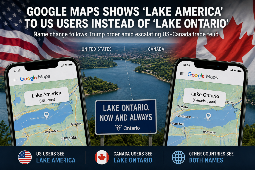
Google Maps has begun displaying Lake Ontario as “Lake America” for users in the United States, following an executive order by President Donald Trump that changed the lake’s official name in US federal records amid an escalating trade dispute with Canada.
The decision affects how one of North America’s five Great Lakes appears depending on where a Google Maps user is located. Americans will see “Lake America,” Canadians will continue to see “Lake Ontario,” while users elsewhere in the world will generally see both names.
Trump order changes US federal designation
Trump signed the executive order on August 27, directing the United States government to rename Lake Ontario as Lake America.
The change has been incorporated into the US Geographic Names Information System, known as GNIS, which establishes official geographical names used by the federal government and serves as an important reference for mapping services.
The American decision does not change Canada’s official designation for the lake, nor does Washington have the authority to determine how Canada or other countries refer to it.
Lake Ontario straddles the international border between the Canadian province of Ontario and the US state of New York.
Google follows official US database
Google said the change was consistent with its established policy of reflecting geographical names contained in official government databases.
As a result, Google Maps users located in the United States will see Lake America, while users in Canada will continue to see Lake Ontario.
People accessing the service from countries outside the United States and Canada will see both designations.
The approach is similar to the one Google adopted after the Trump administration renamed the Gulf of Mexico as the Gulf of America for official US purposes.
Name dispute spreads into digital maps
The unusual dispute has also exposed how political decisions over geographical names can rapidly spread through digital infrastructure.
Several Canadian websites and applications unexpectedly began showing “Lake America” because they use mapping technology based on Google Maps.
Ontario authorities subsequently began reviewing government websites to ensure that they continue identifying the lake as Lake Ontario.
Google explained that developers embedding its maps can specify a geographical region, which determines which local place names are displayed.
The situation means two people looking at essentially the same Google map from opposite sides of the US-Canada border can now see different names for the same body of water.
Canada rejects the new name
Canadian officials have firmly rejected Washington’s designation.
Ontario Premier Doug Ford said the lake had been known as Lake Ontario for hundreds of years and would continue to carry that name in Canada.
Ford reinforced the message by unveiling a large sign near the lake declaring “Lake Ontario, Now and Always.”
The controversy has also drawn criticism from political figures in the United States. The dispute is particularly unusual because Lake Ontario is a shared international body of water and forms part of the boundary between the two countries.
Mapping companies take different approaches
Not every digital mapping service has followed Google’s decision.
MapQuest said it would continue using Lake Ontario, while Apple Maps was still displaying Lake Ontario as of Sunday.
The differing approaches highlight the increasingly complicated position of technology companies when governments adopt competing names for internationally shared geographical features.
For Google, the solution is effectively geographical localisation, displaying the official US designation to Americans while retaining Canada’s official name for Canadian users.
Part of worsening US-Canada trade dispute
The controversy goes beyond cartography.
Trump announced the change as relations between Washington and Ottawa deteriorated over trade, with the two countries imposing reciprocal tariffs covering billions of dollars in goods.
The lake’s renaming has consequently become another symbol of the increasingly confrontational relationship between two countries that historically maintained one of the world’s closest economic and political partnerships.
Trump has argued that Canada benefits disproportionately from its economic and security relationship with the United States. Canadian leaders have rejected that characterisation and responded strongly to Washington’s recent trade measures.
The naming dispute therefore represents a largely symbolic confrontation, but one taking place against the much more consequential background of tariffs, cross border commerce and worsening political relations.
One lake, different names
For the foreseeable future, Lake Ontario will effectively have different identities across digital maps.
In Canada, it remains officially Lake Ontario.
Under the Trump administration’s federal designation, US government maps identify it as Lake America.
Google Maps has chosen to reflect both positions depending on the location of the user, turning an international political dispute into something visible whenever millions of people open a map of North America’s Great Lakes.
The physical geography has not changed, but the name displayed on the screen now depends on which side of the border the viewer happens to be.